Details
360°Laser Ranging Lidar

| Ranging Distance | 0.15 ~ 12.00 m |
|---|---|
| Ranging Accuracy | 1% of actual distance (≤3 m) 2% of actual distance (3~5 m) 2.5% of actual distance (5~12 m) |
| Scanning Frequency | 5.5 Hz |
| Scanning Angle | 360° |
| Ranging Frequency | 8000 Hz |
| Resolution | ≤ 1% of actual distance (≤12 m) ≤ 2% of actual distance (within 12~16 m) |
| Wavelength | 785 nm |
| Communication Interface | UART |
| Power Supply | 5 V |
| Power Consumption | 0.5 W |
| Operating Current | 100 mA |
| Weight | 248 g |
| Operating Temperature | 0°C ~ 40°C |
| Dimensions (L × W × H) |
96.8 × 70.3 × 55.0mm |
With High-speed Visual Acquisition and Processing
Measures Distance Data in More Than 8000 Times Per Second

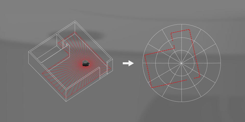
Rotates clockwise in the ranging core to achieve 360-degree scanning and ranging of the surrounding environment, thus obtaining the contour map of the surrounding environment

Improves the internal optical design and algorithm system to make the sample rate up to 8000times/s, which can enable your robots to map faster and more accurately
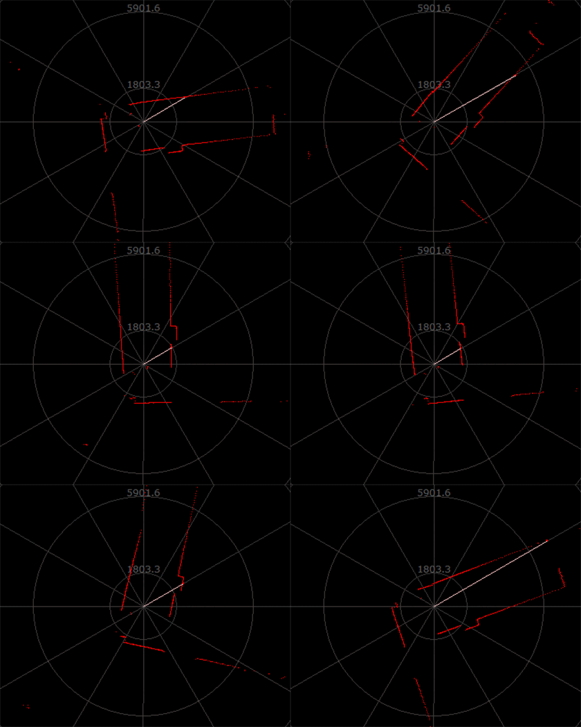
Comparison under different working modes

10Hz 8000 Points

10Hz 4000 Points

5Hz 2000 Points
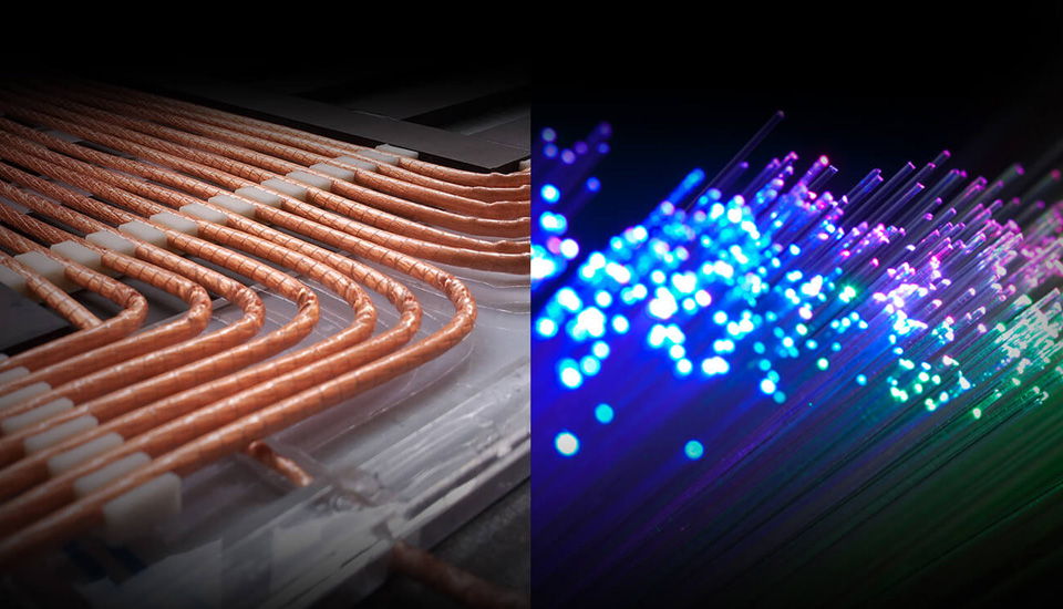
Most traditional non-solid LIDARs use slip ring to transfer power and data information, however, they only have thousands of hours lifetime due to mechanical wear and tear. RPLIDAR A1 has integrated the wireless power and optical communication technology to self-design the OPTMAG technology, which breakouts the life limitation of traditional LIDAR system. It fixes the electrical connection failure caused by the physical wearing out so as to prolong the life-span.

Users can adjust the scan rate by motor PWM signal


Robot Simultaneous Localization And Mapping (SLAM)

Environment Scanning and 3D Reconstruction

Obstacle Detection and Avoidance

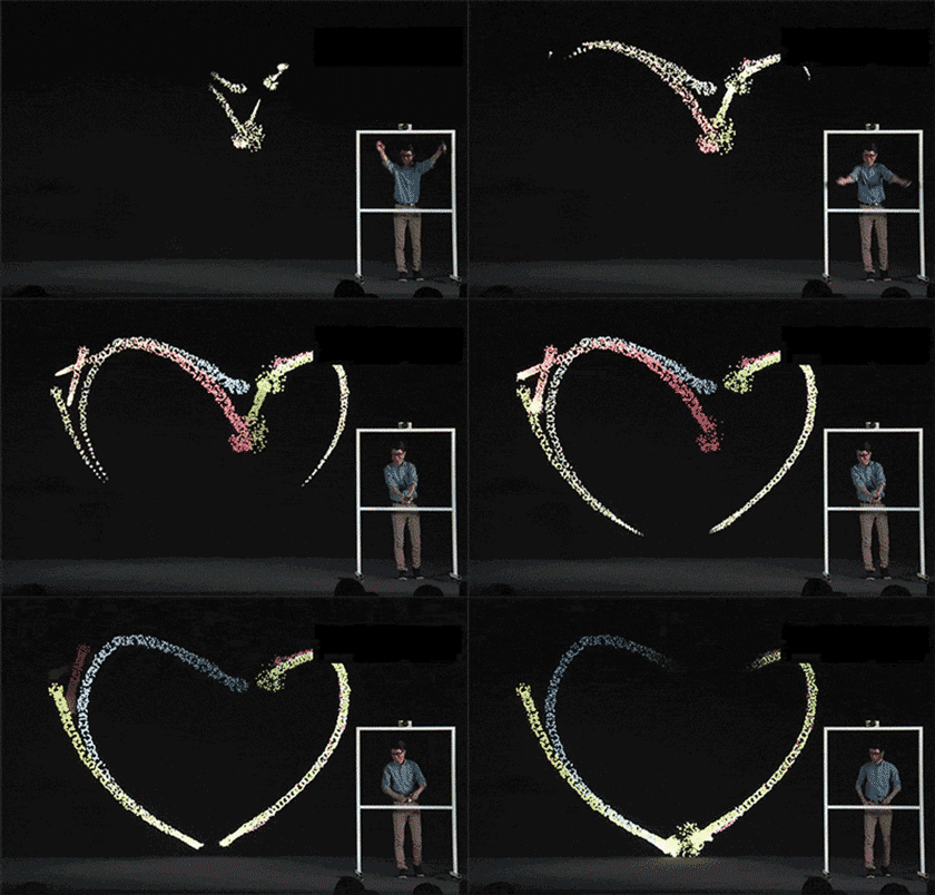
Multi-touch and Human Computer Interaction
Datasheet, User Manual, Application Manual, Protocol Specification


* Resources for different product may vary, please check the wiki page to confirm the actually provided resources.
| Product | RPLIDAR A1 | RPLIDAR C1 | D500 LiDAR Kit | D200 LiDAR Kit | DTOF LIDAR STL27L |
|---|---|---|---|---|---|
| RANGING DISTANCE | 0.15 ~ 12.00 m | 0.05~12.00m (white object, 70% reflectivity) 0.05~6.00m (black object, 10% reflectivity) |
0.03~12.00m | 0.15 ~ 8.00 m | 0.03~25.00 m |
| RANGING ACCURACY | 1% of actual distance (≤3 m) | ±30mm | ±10 mm (0.3 ~ 0.5m) ±20mm (0.5 ~ 2m) ±30mm (2 ~ 12m) |
White target: ±5mm (0.1~0.5m) ±10mm (0.5~1m) ±1.0% of actual distance (1~6 m) ±1.5% of actual distance (6~8 m) |
±15mm (0.03~2m) ±20mm (2~8m) ±30mm (>8m) |
| Black target: ±7mm (0.1~0.5m) ±12mm (0.5~1m) ±1.2% of actual distance (1~4 m) ±1.5% of actual distance (4~6 m) NA (6~8m) |
|||||
| SCANNING FREQUENCY | 5.5 Hz | 8~12Hz (Typ 10) | 6~13Hz (Typ 10) | 6Hz by default, 2 ~ 8 Hz externally controllable | 10 Hz |
| SCANNING ANGLE | 360° | 360° | 360° | 360° | 360° |
| RANGING FREQUENCY | 8000 Hz | 5000 Hz | 5000 Hz | 4000Hz | 21600Hz |
| RESOLUTION | ≤ 1% of actual distance (≤12 m) ≤ 2% of actual distance (within 12~16 m) |
15 mm | 15 mm | ≈ 17 mm | 15~30 mm |
| WAVELENGTH | 785 nm | 905 nm | 895 ~ 915 nm (Typ 905) | 775 ~ 800 nm (Typ 793) | 895 ~ 915 nm (Typ 905) |
| COMMUNICATION INTERFACE | UART | UART, TTL | UART | UART | UART |
| POWER SUPPLY | 5 V | 5 V | 5 V | DC 5V±10% | 4.5~5V |
| POWER CONSUMPTION | 0.5 W | 1.15W | 1.45W | ≈ 1.5 W | 1.45W |
| OPERATING CURRENT | 100mA | 230mA | 290mA | ≤300mA | 290mA |
| WEIGHT | 248g | 110g | 45g | 101g | 46.1g |
| OPERATING TEMPERATURE | 0°C ~ 40°C | -10 ~ 40°C | -10 ~ 45°C | -10°C ~ 50°C | -10°C ~ 50°C |
| DIMENSIONS(L × W × H) | 96.8 × 70.3 × 55.0mm | 55.60 × 55.60 × 41.3mm | 54.00 × 46.29 × 35.00 | 96.3 × 59.8 × 38.80mm | 54.00 × 46.29 × 34.80mm |


